Scan to CAD
From$0.35/ sq ftplus deployment
- FAA-certified drone captures
- Clean CAD / Revit exports
- Automated QA/QC checks
- Standard VR delivery
Technician on site
Raw data
Full set
2-3 days
24 hours
10-14 days
Two service tracks
From$0.35/ sq ftplus deployment
From$0.75/ sq ftplus deployment
Five phases, and every clock below is a number they publish rather than an estimate. Volume programs run the same sequence per location, in parallel.
2 - 3 days
Send one address or a spreadsheet of two hundred. A certified technician is dispatched nationally, and scheduling runs around the clock through the mobile app.
1 - 3 days
Most retail locations fall in the one-day range. The instrument is matched to the building: a BLK 360 G2 for retail, an RTC 360 with survey control for industrial, a Pro3 for the walkthrough.
3 - 5 hours
ParallelFAA Part 107 pilots fly roof, exterior and site inside the same visit. Orthomosaic, 3D model and thermal imagery, with DroneDeploy integration.
24 hours
Ground and aerial land in a single coordinate system and the raw spatial data is released inside 24 hours. Real geometry a day after the visit.
10 - 14 days
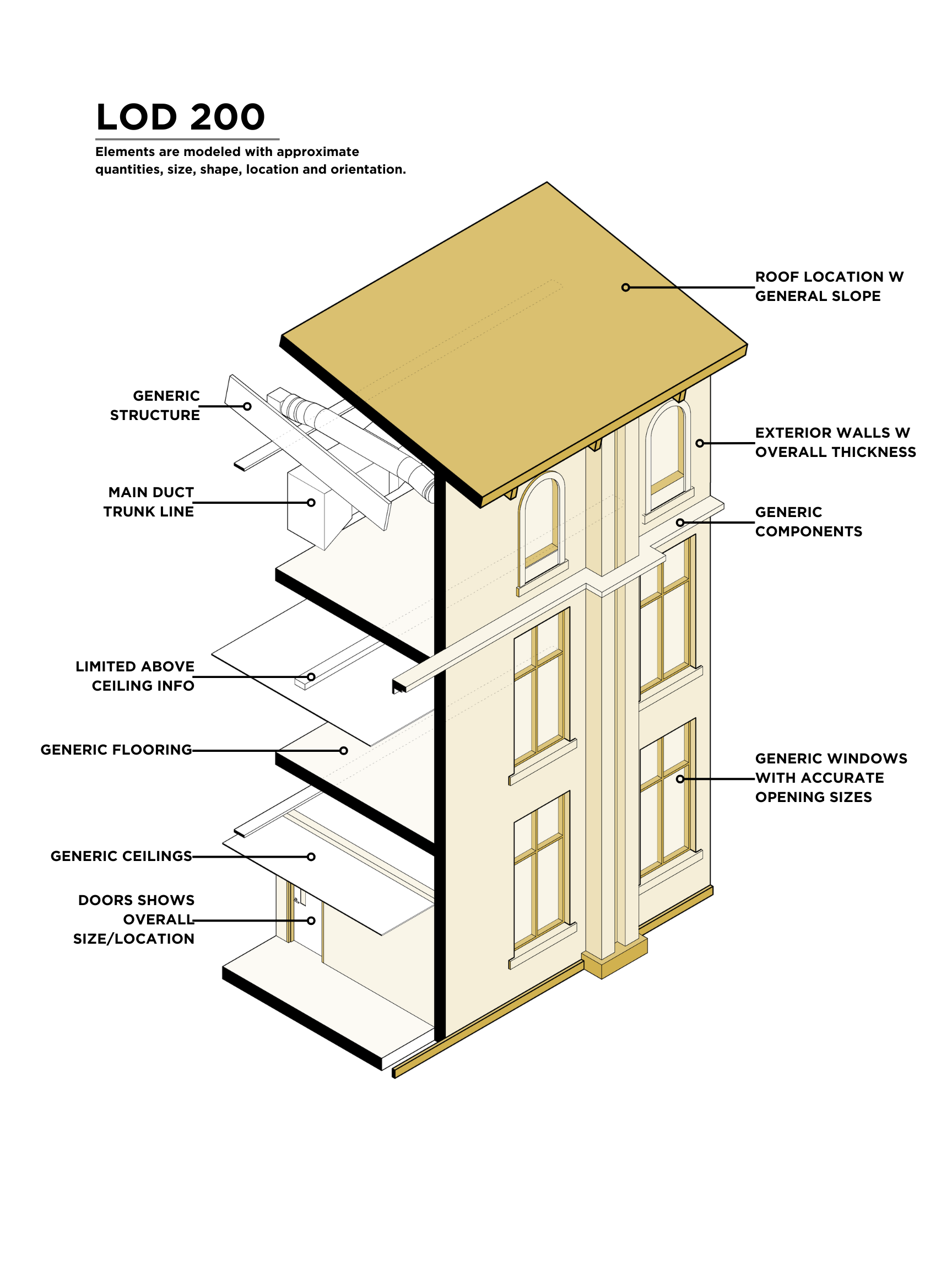
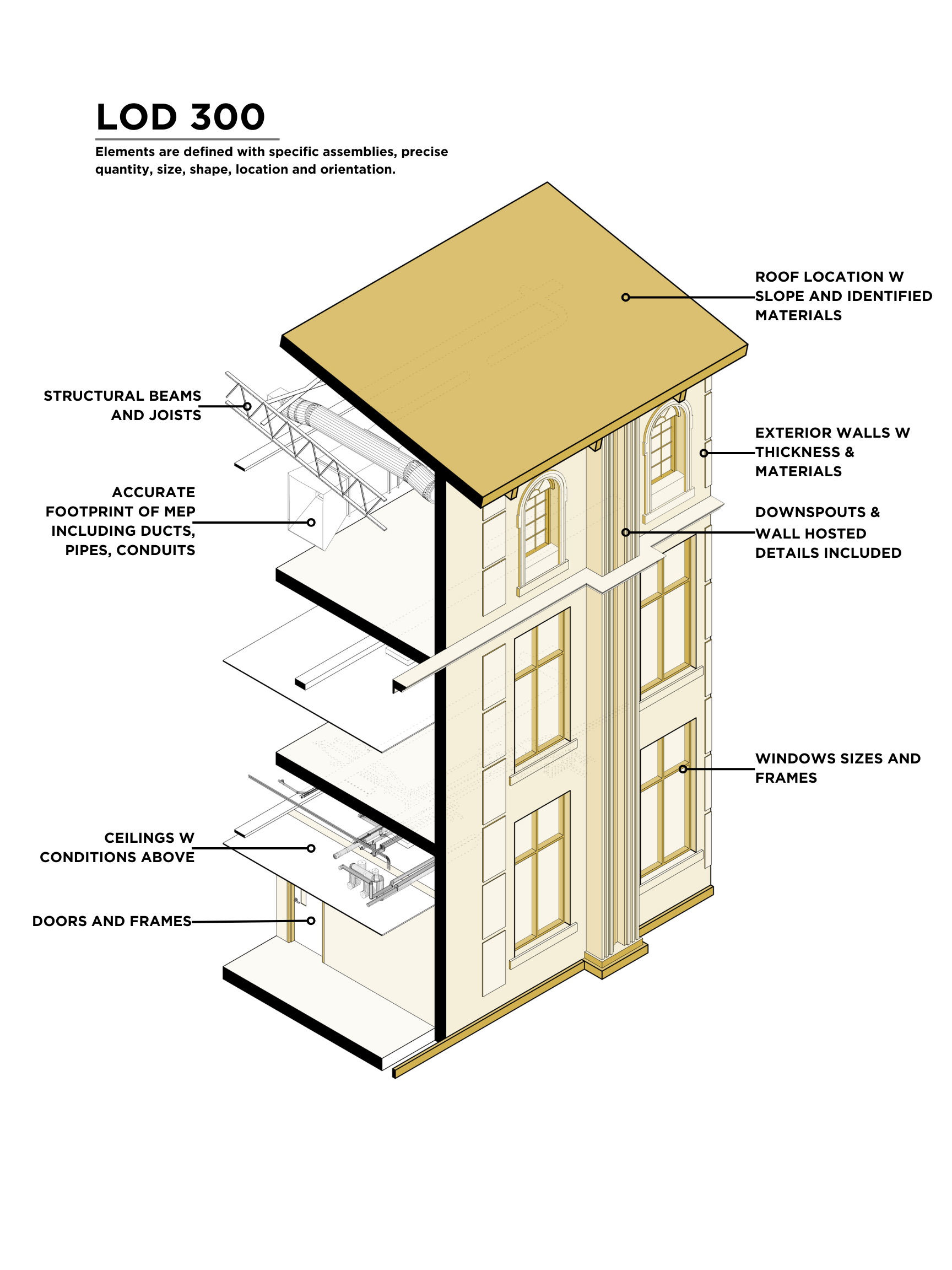
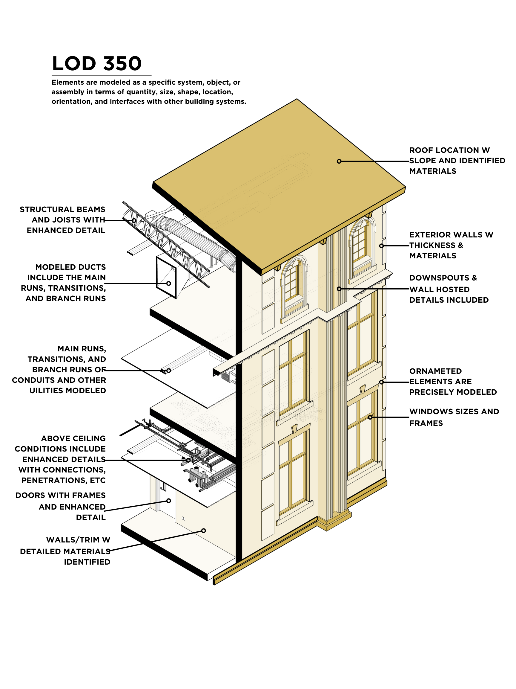
Reality data is traced into Revit, AutoCAD or SketchUp, checked by automated QA/QC, and the complete set lands 10 to 14 business days from scheduling.
That is 50 to 80 percent faster than traditional surveying and
documentation alternatives, and roughly 10 times faster on
the documentation itself.
3D point accuracies from controlled manufacturer testing. Real-world results vary slightly with surface reflectivity, ambient lighting and site conditions.
The capture stack
Software
90-Second Mobile Video IngestionSoftware
Walkthrough
100,000 pts / secWalkthrough
Retail foundation
680,000 pts / secRetail foundation
Industrial foundation
2,000,000 pts / secIndustrial foundation
Almost nobody in reality capture puts a number on a public page. These two have been on theirs for years, and volume pricing applies across multi-location programs.
3D scan & CAD
$0.35
From / sq ft
Scan to BIM
$0.75
From / sq ft
$300,000
Site visits, 200-store program
One architect site visit costs upward of $1,500. Across a 200-store renovation program that is a $300,000 line item spent before anyone has drawn anything.
$500K-$1.5M
Documentation spend removed
What a 100-store portfolio typically stops paying for once the capture program exists, against scanning priced at four cents a square foot.
$5,000-$15,000
Audit fee, per location
The professional audit is the only systematic capture most portfolios have. It stops being the mechanism once your own teams keep the record current.
Retail is the majority of the field schedule. The rest of the book looks like this.
Start with one site
Tell us one location. We will dispatch a certified technician in two to three days and you will have raw spatial data inside 24 hours.